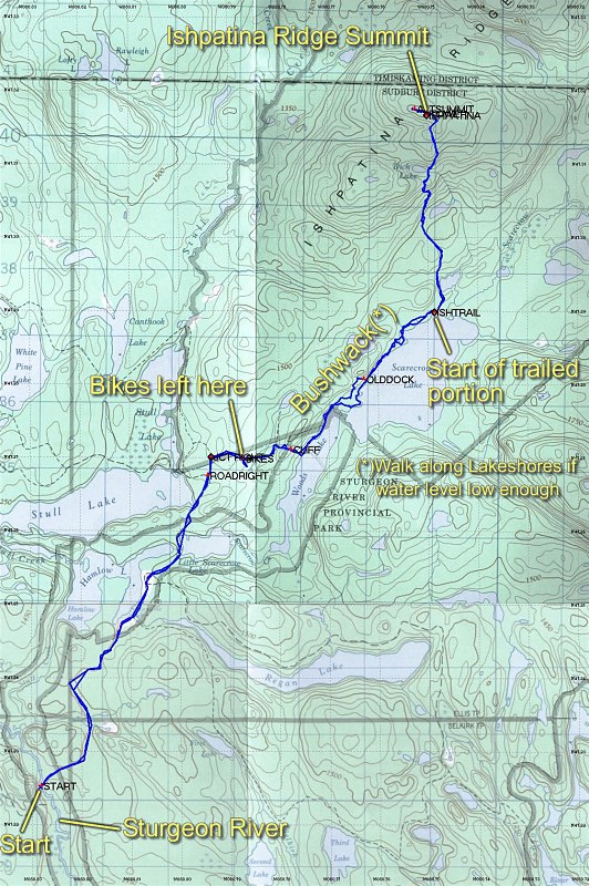
A GSC topo map with our GPS tracklog overlain. Also includes useful annotations, outlining where we started, stopped using bikes, the bushwack portion, and the trailed portion.
This image is from the presentation "Ishpatina Ridge - The Highpoint of Ontario".
 Go to presentation where this image occurs.
Go to location in presentation where this image occurs.
Go to presentation where this image occurs.
Go to location in presentation where this image occurs.
Copyright 2001-2016 alavigne.net.