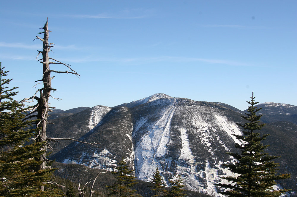
Here's a view of Mount Colden and the Trap Dike, as seen from up near Boundary Peak. This shot was taken in February of 2005. The dike is the near vertical line in the center of the picture, cutting up Mount Colden. The route goes up this feature, then exits onto the slab at a point near the upper edge of the big, wide open slab (not the little slab section higher up). the route then goes up the slab directly to the summit.
This image is from the presentation "Winter Climb of the Trap Dike on Mt Colden".
 Go to presentation where this image occurs.
Go to location in presentation where this image occurs.
Go to presentation where this image occurs.
Go to location in presentation where this image occurs.
Copyright 2001-2016 alavigne.net.