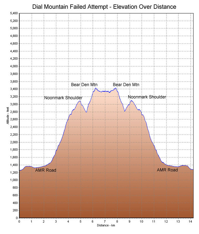
A GPS-derived plot of our failed Dial summit attempt, graphed over distance.
This image is from the presentation "Dial Mountain Failed Attempt".
 Go to presentation where this image occurs.
Go to location in presentation where this image occurs.
Go to presentation where this image occurs.
Go to location in presentation where this image occurs.
Copyright 2001-2016 alavigne.net.