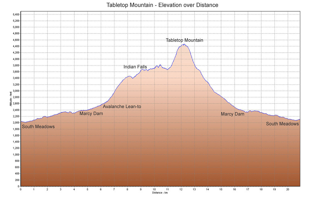
This is a GPS-derived elevation profile of our Tabletop mountain ascent, graphed over distance.
This image is from the presentation "Near Failure on Tabletop Mountain".
 Go to presentation where this image occurs.
Go to location in presentation where this image occurs.
Go to presentation where this image occurs.
Go to location in presentation where this image occurs.
Copyright 2001-2016 alavigne.net.