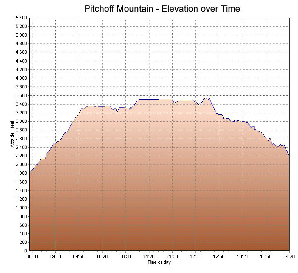
This is a GPS-derived graph of the elevation profile of the hike (from East to West), over time.
This image is from the presentation "Pitchoff Ridge Traverse".
 Go to presentation where this image occurs.
Go to location in presentation where this image occurs.
Go to presentation where this image occurs.
Go to location in presentation where this image occurs.
Copyright 2001-2016 alavigne.net.