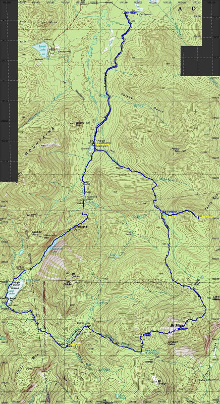
This is a topographic map of the area of the hike, with a GPS-derived tracklog overlain. Total distance was 32.7km. Total time: 13 hours. Average speed: 2.5 km/hr.
This image is from the presentation "Becoming a 46er - Gray Peak and Marcy Traverse, plus Tabletop".
 Go to presentation where this image occurs.
Go to location in presentation where this image occurs.
Go to presentation where this image occurs.
Go to location in presentation where this image occurs.
Copyright 2001-2016 alavigne.net.