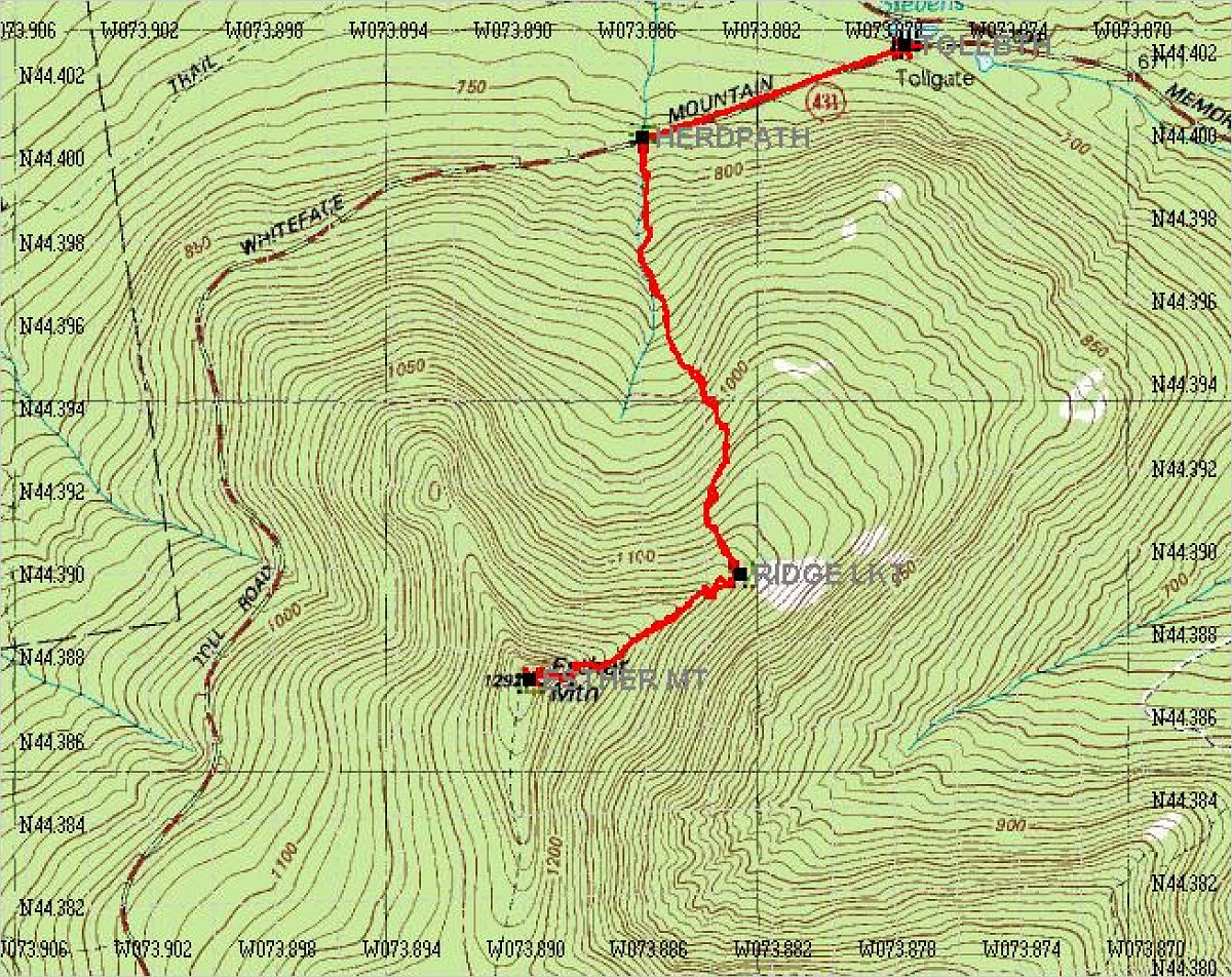
Annotated Topo Map
This is an annotated topo map of our climb. Total distance: 5.84km. Av speed: 1.2km/hr. Elevation gain: 1900 feet.
This is an annotated topo map of our climb. Total distance: 5.84km. Av speed: 1.2km/hr. Elevation gain: 1900 feet.

This image is from the presentation "Esther Mountain Bushwhack".
 Go to presentation where this image occurs.
 Go to location in presentation where this image occurs.
 Go to presentation where this image occurs.
 Go to location in presentation where this image occurs.
Copyright 2001-2016 alavigne.net.
