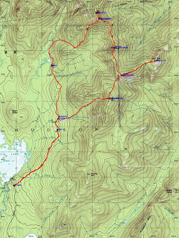
This is a topo map of the Dix Range hike, with a GPS-derived tracklog overlain on top.
This image is from the presentation "Dixes 2004".
 Go to presentation where this image occurs.
Go to location in presentation where this image occurs.
Go to presentation where this image occurs.
Go to location in presentation where this image occurs.
Copyright 2001-2016 alavigne.net.