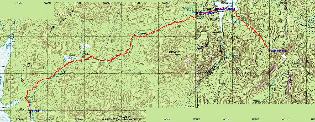
Annotated Topo Map of Hike
This is the GPS-derived track of the route overlain onto a topographic map of the area.
Total distance: 9.39km one-way (round-trip = 18.77km)
Start Time : 8:03 am; End Time: 3:10 pm (7 hours 7 minutes)
Average speed (including stops): 2.6 km/hr
Total elevation gain: ~2100 feet
This image is from the presentation "Cliff Mountain Winter Route, Second Attempt".
 Go to presentation where this image occurs.
Go to location in presentation where this image occurs.
Go to presentation where this image occurs.
Go to location in presentation where this image occurs.
Copyright 2001-2016 alavigne.net.