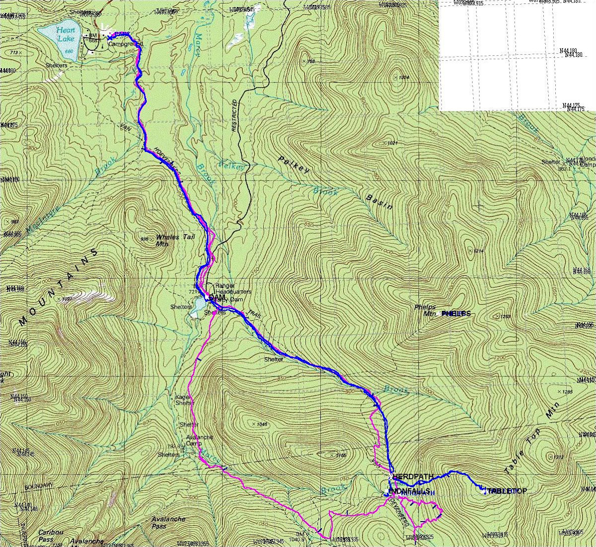
This is the GPS-derived track of our route, superimposed over a USGS topographic map of the area. Superimposed on top of that in purple is the track from our January 15 attempt on Tabletop. Note how our unsuccessful bushwhack attempt to the summit was at one point only 190 metres from the real trail to the top. Argh! (click here to read about that attempt on tabletop).
This image is from the presentation "Tabletop Mountain, Take II".
 Go to presentation where this image occurs.
Go to location in presentation where this image occurs.
Go to presentation where this image occurs.
Go to location in presentation where this image occurs.
Copyright 2001-2016 alavigne.net.