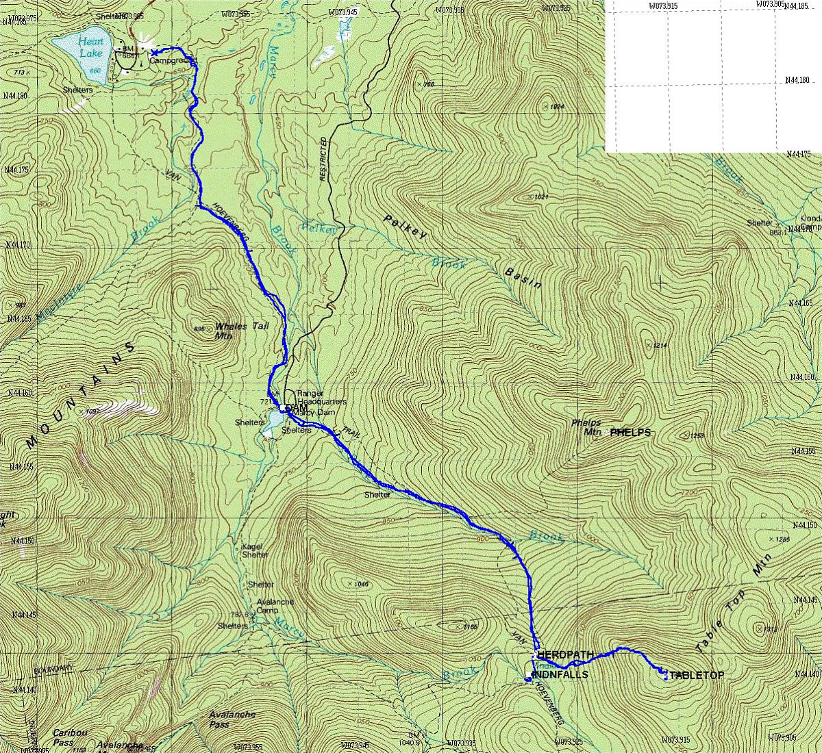
This is the GPS-derived track of our route, superimposed over a USGS topographic map of the area.
This image is from the presentation "Tabletop Mountain, Take II".
 Go to presentation where this image occurs.
Go to location in presentation where this image occurs.
Go to presentation where this image occurs.
Go to location in presentation where this image occurs.
Copyright 2001-2016 alavigne.net.