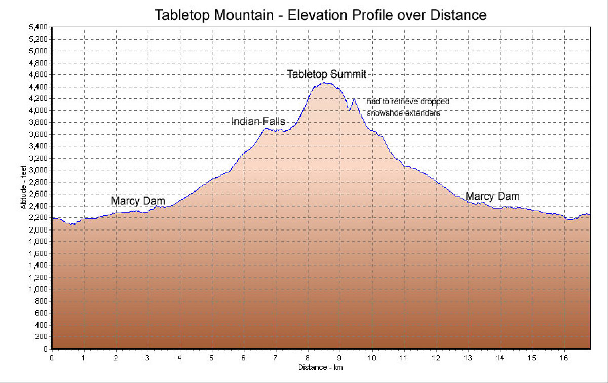
This is the GPS-derived elevation profile of our hike, over distance. Note the little spike where I had to labouriously retrace my steps to retrieve the extenders to my snowshoes, which I had dropped while glissading down the trail.
This image is from the presentation "Tabletop Mountain, Take II".
 Go to presentation where this image occurs.
Go to location in presentation where this image occurs.
Go to presentation where this image occurs.
Go to location in presentation where this image occurs.
Copyright 2001-2016 alavigne.net.