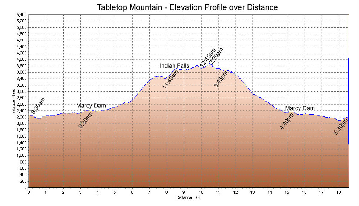
This chart is a GPS-derived representation of our elevation changes over distance. I've also put in timestamps to highlight how slow our bushwacking progress was.
This image is from the presentation "Tabletop Mountain".
 Go to presentation where this image occurs.
Go to location in presentation where this image occurs.
Go to presentation where this image occurs.
Go to location in presentation where this image occurs.
Copyright 2001-2016 alavigne.net.