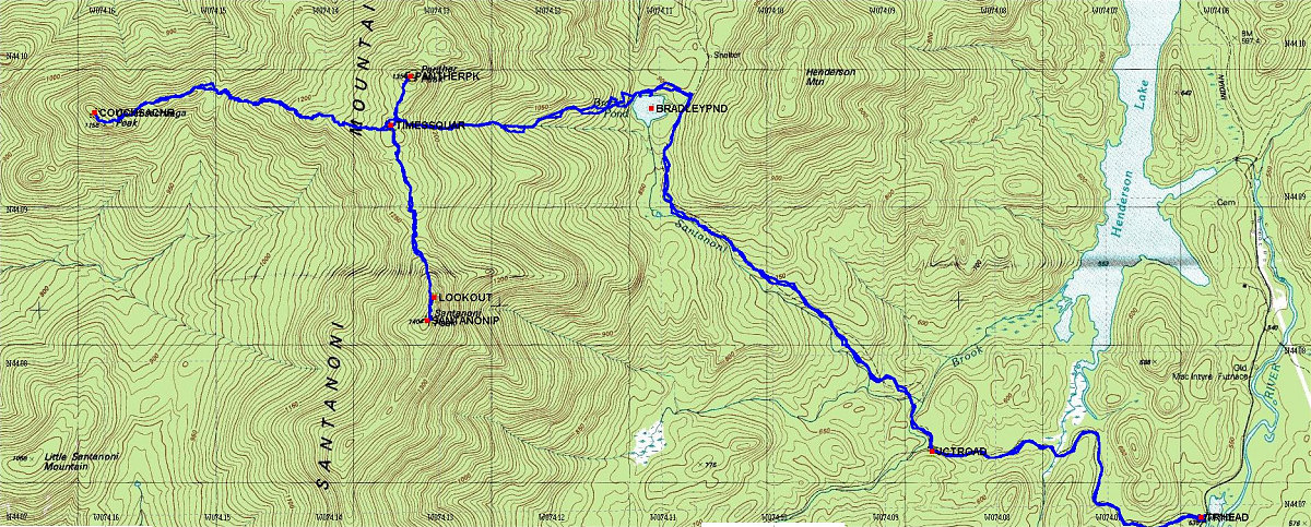
This is a topographic map of the area covered by the hike, with our exact route (derived from GPS data) superimposed. You will note that due to the fact there is no maintained trail, we chose different herd path routes (inadvertently) at a couple of spots (ie. different going down than going up).
This image is from the presentation "The Santanoni Peaks".
 Go to presentation where this image occurs.
Go to location in presentation where this image occurs.
Go to presentation where this image occurs.
Go to location in presentation where this image occurs.
Copyright 2001-2016 alavigne.net.