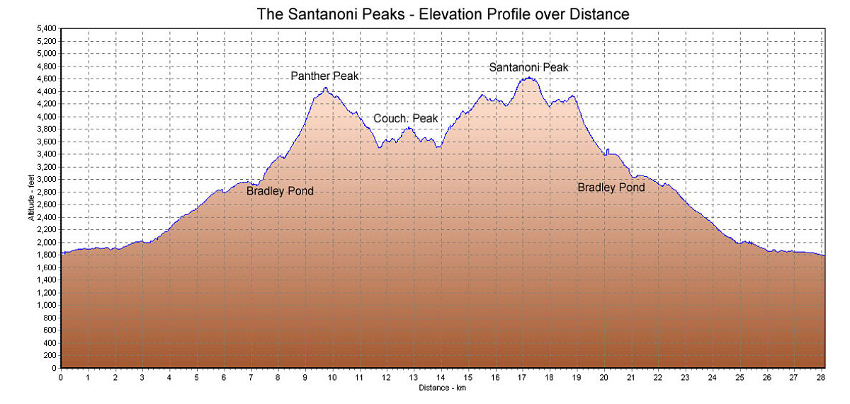
This is a GPS-derived tracklog of the elevation over distance. We traversed the route by going up Panther first, then Couch, then Santanoni.
This image is from the presentation "The Santanoni Peaks".
 Go to presentation where this image occurs.
Go to location in presentation where this image occurs.
Go to presentation where this image occurs.
Go to location in presentation where this image occurs.
Copyright 2001-2016 alavigne.net.