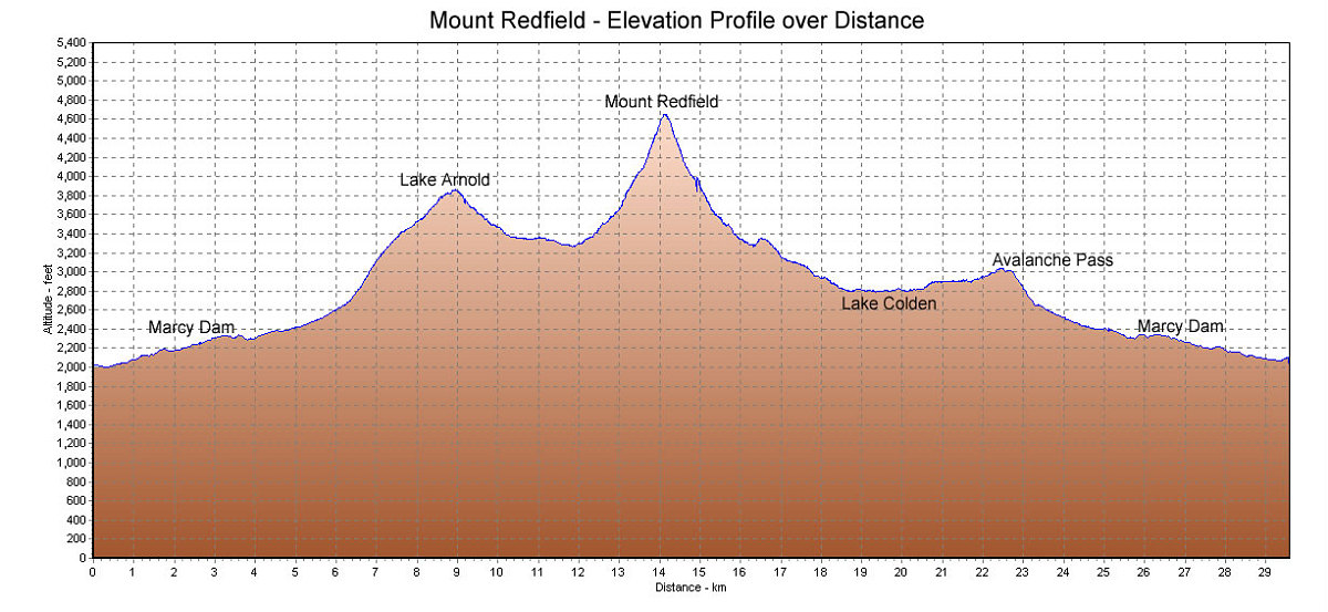
This is the GPS-derived profile of the elevation, graphed over distance. We chose to go up over the pass at Lake Arnold, and return via Lake Colden and Avalanche Pass.
This image is from the presentation "Mount Redfield".
 Go to presentation where this image occurs.
Go to location in presentation where this image occurs.
Go to presentation where this image occurs.
Go to location in presentation where this image occurs.
Copyright 2001-2016 alavigne.net.