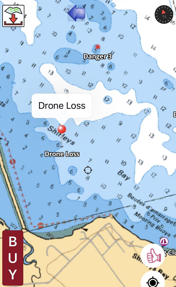
Last Known Location
Fortunately, the drone transmits a realtime tracklog of its location back to its controller. That tracklog now showed the last coordinate as being a point in the Ottawa River about 500 metres out from the shore of the Ottawa River at a spot called "Shirleys Bay", near Ottawa. The depth of the water looks to be right at the top edge of a 6-to-11 foot downslope.
Fortunately, the drone transmits a realtime tracklog of its location back to its controller. That tracklog now showed the last coordinate as being a point in the Ottawa River about 500 metres out from the shore of the Ottawa River at a spot called "Shirleys Bay", near Ottawa. The depth of the water looks to be right at the top edge of a 6-to-11 foot downslope.

This image is from the presentation "The GTS Chronicles - Two Sportscars via Porsche European Delivery - Lead-up".
 Go to presentation where this image occurs.
 Go to location in presentation where this image occurs.
 Go to presentation where this image occurs.
 Go to location in presentation where this image occurs.
Copyright 2001-2016 alavigne.net.
