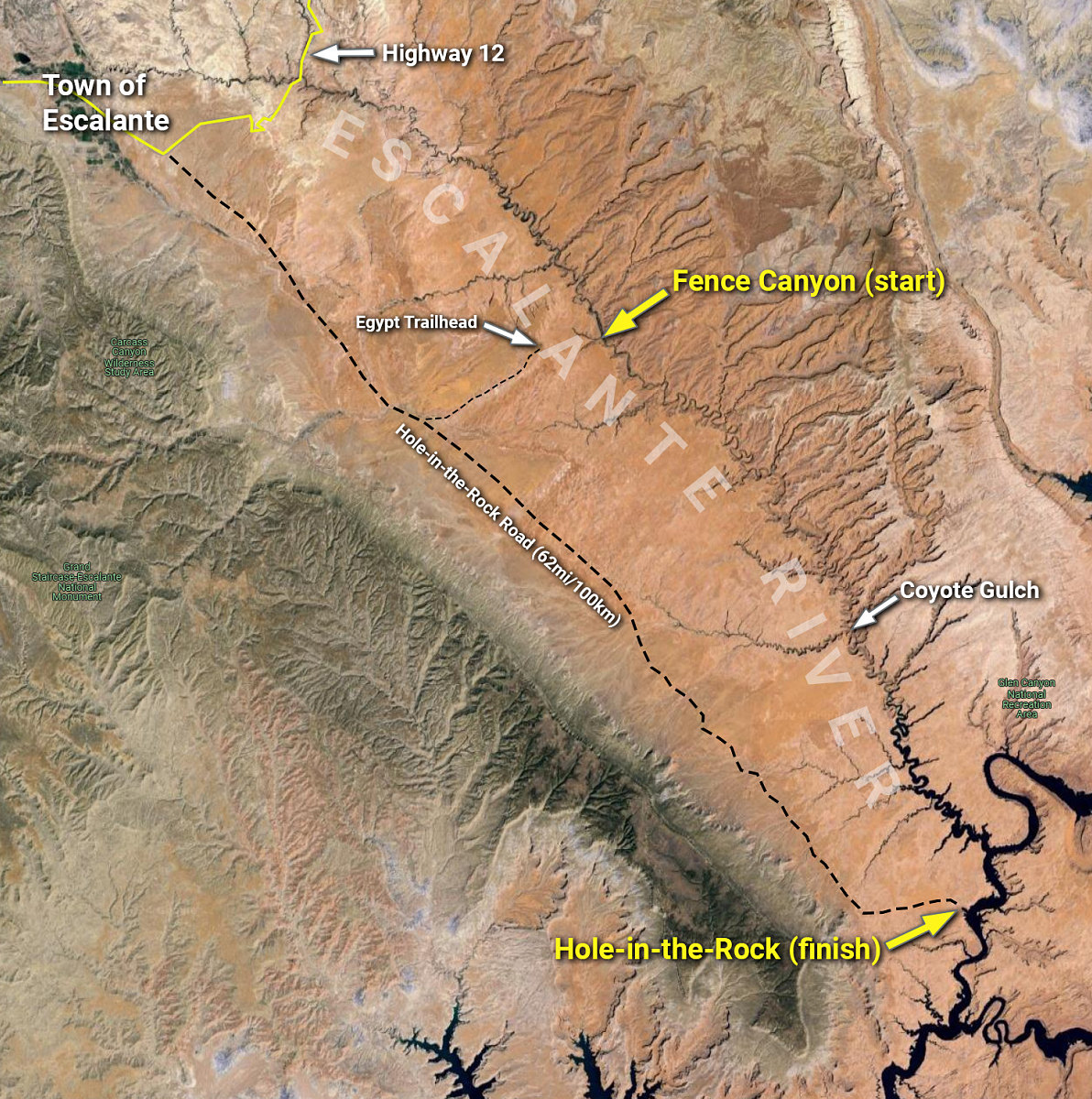
Above is a map and diagram with the key points of our intended route: hike down from the Egypt Trailhead to the Escalante River at Fence Canyon, then paddle all the way down the remaining length to Lake Powell and the Colorado River, then around and exit at Hole-in-the-Rock. Roughly 110km / 70 miles of paddling, by our estimation.
This image is from the presentation "The Escalante Packraft Trip".
 Go to presentation where this image occurs.
Go to location in presentation where this image occurs.
Go to presentation where this image occurs.
Go to location in presentation where this image occurs.
Copyright 2001-2016 alavigne.net.