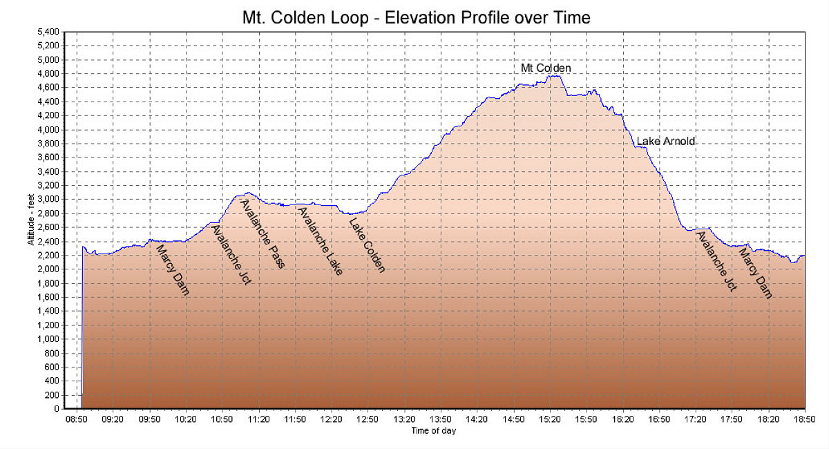
This is a GPS-derived elevation plot of the day's hike, plotted over time. Took us just under 10 hours.
This image is from the presentation "Mt Colden Winter Hike".
 Go to presentation where this image occurs.
Go to location in presentation where this image occurs.
Go to presentation where this image occurs.
Go to location in presentation where this image occurs.
Copyright 2001-2016 alavigne.net.