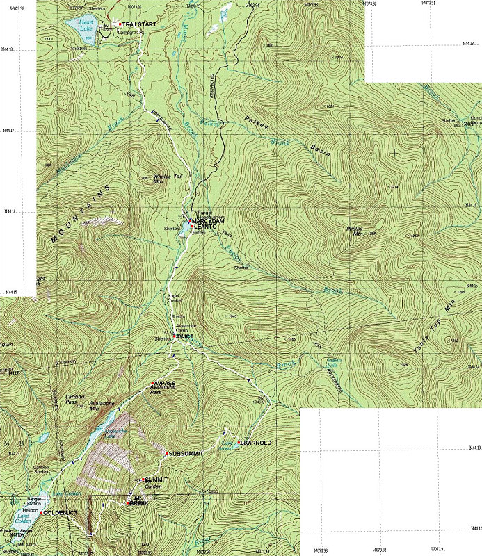
This is a topographic map of the area in which our hike took place. Overlaid on top of the map is a GPS-derived tracklog of our exact route. Each dark blue tick along the track represents 30 minutes of elapsed time.
Hike Specifics: Start 08:50; End 18:50; Total Distance: 21.5-22.0km; Start Elevation: appr 2200 feet. Max Elevation: 4715 feet.
This image is from the presentation "Mt Colden Winter Hike".
 Go to presentation where this image occurs.
Go to location in presentation where this image occurs.
Go to presentation where this image occurs.
Go to location in presentation where this image occurs.
Copyright 2001-2016 alavigne.net.