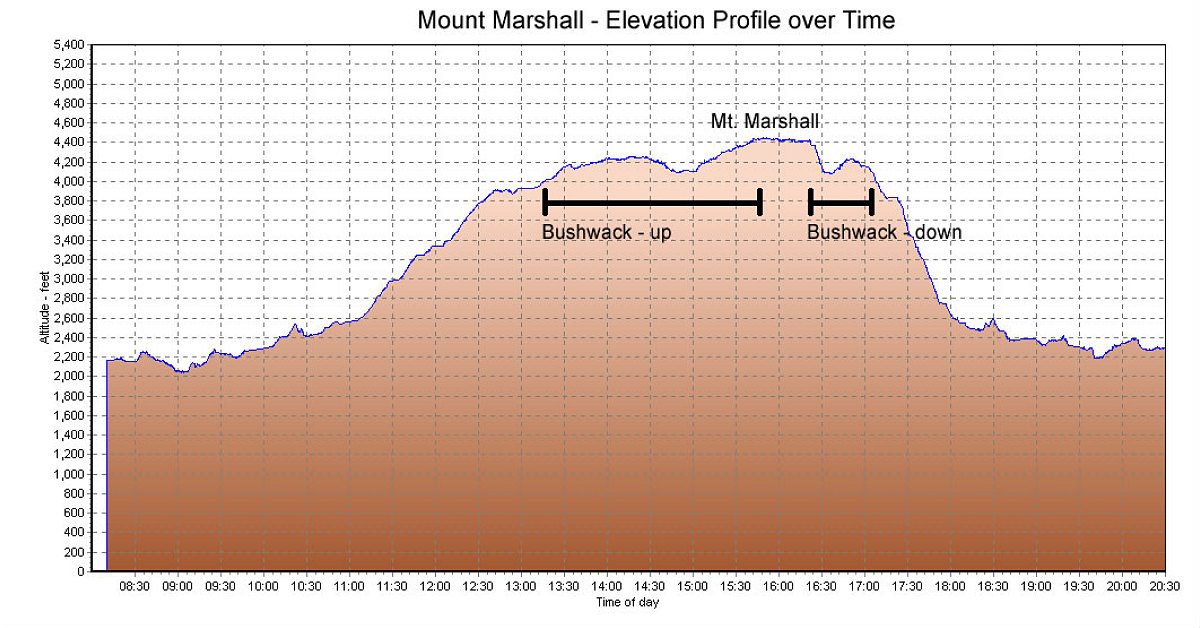
This is the GPS-derived elevation profile of our hike, over time. I've marked the time it took to bushwack a route up Marshall, and the time it took to come back down the same route. Makes quite a difference having a packed trail to follow.
This image is from the presentation "Mount Marshall via ADK Loj".
 Go to presentation where this image occurs.
Go to location in presentation where this image occurs.
Go to presentation where this image occurs.
Go to location in presentation where this image occurs.
Copyright 2001-2016 alavigne.net.