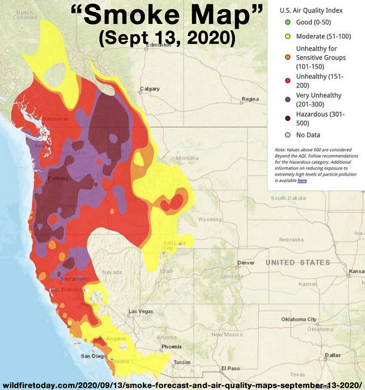
A smoke map for today - September 13. Note how the "Very Unhealthy" and "hazardous" smoke zones are pushing into extreme southwestern Alberta. And how maybe, just maybe, driving north for a few hundred kilometres might allow us to escape it.
This image is from the presentation "Smoky Rockies".
 Go to presentation where this image occurs.
Go to location in presentation where this image occurs.
Go to presentation where this image occurs.
Go to location in presentation where this image occurs.
Copyright 2001-2016 alavigne.net.