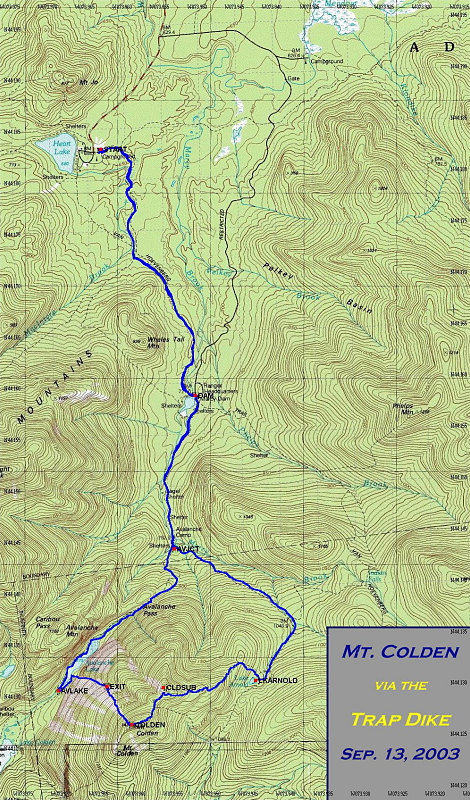
This is a GPS-derived track of our hike. The tracklog is available here. (the shareware program GPS Utility was used to generate this file and can be used to read it).
This image is from the presentation "Colden via Trap Dike".
 Go to presentation where this image occurs.
Go to location in presentation where this image occurs.
Go to presentation where this image occurs.
Go to location in presentation where this image occurs.
Copyright 2001-2016 alavigne.net.