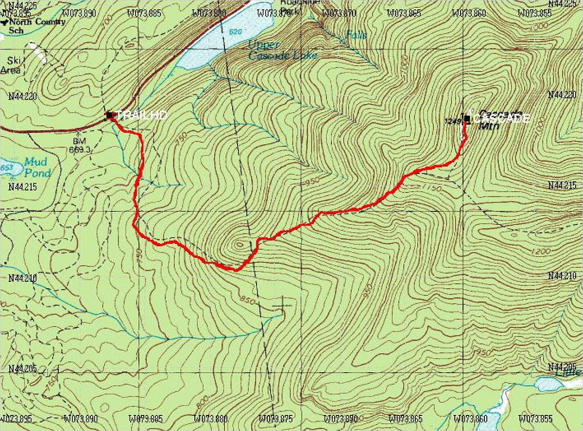
This is a topographic map of the hike, overlain with the GPS-generated track of the hike. Waypoints from my GPS data are also drawn in.
Details:
Start time: 11:18 am
End time: 5:02 pm
Total distance: 7.12 km
Average Speed (including stops): 1.2 km/hr
Start Elevation: ~2150 feet
Maximum Elevation: 4098 feet
Total Elevation Gain: ~1950 feet.
This image is from the presentation "Cascade Mountain".
 Go to presentation where this image occurs.
Go to location in presentation where this image occurs.
Go to presentation where this image occurs.
Go to location in presentation where this image occurs.
Copyright 2001-2016 alavigne.net.