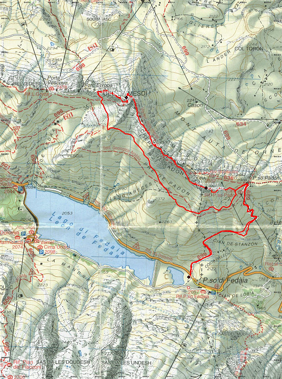
This is a GPS-dervied annotated topographic map of our climb along the Via Ferrata delle trincee. The red line denotes our actual route, as captured by my GPS.
This image is from the presentation "Via Ferrata delle Trincee".
 Go to presentation where this image occurs.
Go to location in presentation where this image occurs.
Go to presentation where this image occurs.
Go to location in presentation where this image occurs.
Copyright 2001-2016 alavigne.net.