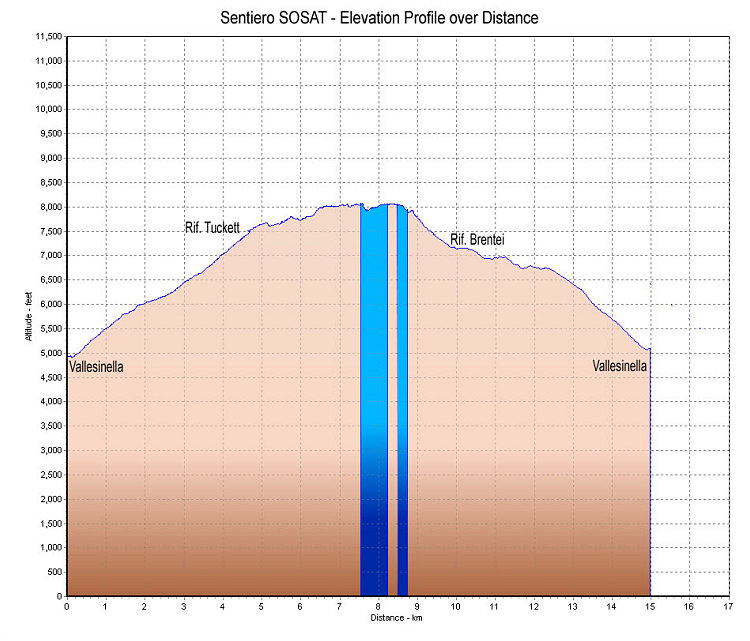
This is a GPS-derived elevation profile of a loop hike of Sentiero SOSAT, starting and ending at the upper Vallesinella parking lot. The 'up' route takes trail 317 to Rifugio Tuckett, then 303/305 across the Sentiero SOSAT, then down trail 323 to the Rifugio Brentei, and back to Vallesinella via 318 and 317.
This image is from the presentation "Via Ferrata - Protected Climbing Paths in the Dolomites - Sentiero SOSAT".
 Go to presentation where this image occurs.
Go to location in presentation where this image occurs.
Go to presentation where this image occurs.
Go to location in presentation where this image occurs.
Copyright 2001-2016 alavigne.net.