This Topographic Map shows the route up both of these ferrate. The blue line is derived from an actual GPS tracklog of our path. On the return path (Path #666) we lost the GPS signal for a little while in the gully, so there is no line for that part.
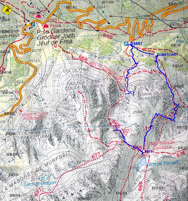
This image is from the presentation "Via Ferrata - Protected Climbing Paths in the Dolomites - Via Ferrata Brigata Tridentina".
 Go to presentation where this image occurs.
Go to location in presentation where this image occurs.
Go to presentation where this image occurs.
Go to location in presentation where this image occurs.
Copyright 2001-2016 alavigne.net.