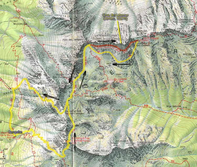
This is the topographic map which shows the via ferrata and our route for the day. The yellow and red track indicates the path we followed for the day. Yellow denotes a hiking path (nothing technical) and red denotes a Via Ferrata section.
This image is from the presentation "Via Ferrata - Protected Climbing Paths in the Dolomites - Via Ferrata Campanili di Latemar".
 Go to presentation where this image occurs.
Go to location in presentation where this image occurs.
Go to presentation where this image occurs.
Go to location in presentation where this image occurs.
Copyright 2001-2016 alavigne.net.