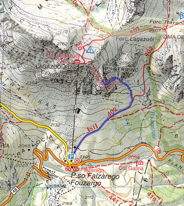
Annotated Topographic Map
Topographic Map showing our route to/fromo the Lagazuoi galleries (not GPS-derived).
Topographic Map showing our route to/fromo the Lagazuoi galleries (not GPS-derived).

This image is from the presentation "Via Ferrata - Protected Climbing Paths in the Dolomites - Via Ferrata Lagazuoi Tunnels".
 Go to presentation where this image occurs.
 Go to location in presentation where this image occurs.
 Go to presentation where this image occurs.
 Go to location in presentation where this image occurs.
Copyright 2001-2016 alavigne.net.
