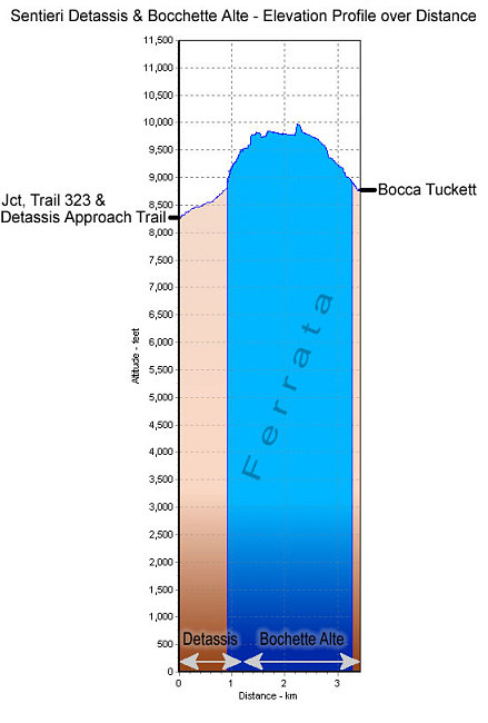
This is a GPS-derived elevation profile of both the Sentiero Oliva Detassis and the Sentiero Bocchette Alte. The blue portion indicates ferrata sections. Note that this elevation profile does not show most of the approach or departure elevation profiles. The start point on the left is at the Junction of trails 323 and the detassis approach trail, and on the right the profile ends at the Bocca del Tuckett.
This image is from the presentation "Via Ferrata - Protected Climbing Paths in the Dolomites - Sentiero Oliva Detassis and Sentiero Bochette Alte".
 Go to presentation where this image occurs.
Go to location in presentation where this image occurs.
Go to presentation where this image occurs.
Go to location in presentation where this image occurs.
Copyright 2001-2016 alavigne.net.