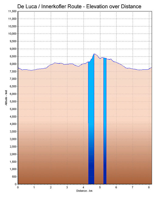
This is a GPS-derived elevation profile of the Alleghesi route, graphed over distance. The blue indicates ferrata sections (including the tunnel sections).
This image is from the presentation "Via Ferrata - Protected Climbing Paths in the Dolomites - De Luca / Innerkofler Route".
 Go to presentation where this image occurs.
Go to location in presentation where this image occurs.
Go to presentation where this image occurs.
Go to location in presentation where this image occurs.
Copyright 2001-2016 alavigne.net.