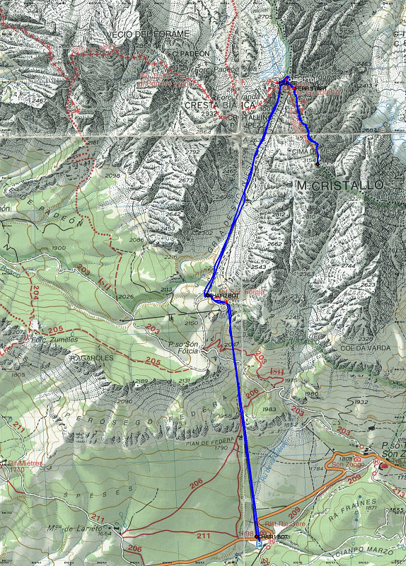
This is an annotated topographic map of our climb up the Middle Cristallo. Our actual GPS track is shown on the map by a blue line. Note the two chairlift sections that get you up to the rifugio Lorenzi and the start of the climb.
This image is from the presentation "Italy 2005 - The Dolomites".
 Go to presentation where this image occurs.
Go to location in presentation where this image occurs.
Go to presentation where this image occurs.
Go to location in presentation where this image occurs.
Copyright 2001-2016 alavigne.net.