Akamina Ridge Route
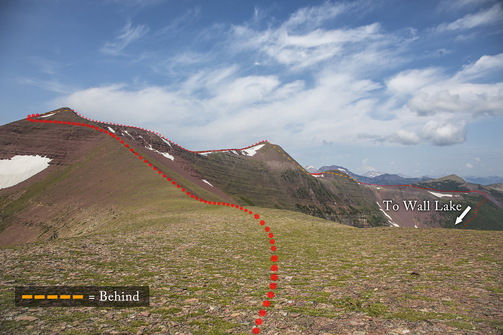
An annotated picture, showing the route drawn onto the terrain. Yellow dashed sections are parts that are "behind" the terrain ,from this point of view. This photo was taken from the eastern end of the ridge, not far from the top of Forum Peak.
An annotated picture, showing the route drawn onto the terrain. Yellow dashed sections are parts that are "behind" the terrain ,from this point of view. This photo was taken from the eastern end of the ridge, not far from the top of Forum Peak.

This image is from the presentation "Astride the Divide - Rocky Mountains - Forum Peak Scramble, Akamina Ridge, and Wall Lake Loop - Waterton Lakes National Park".
 Go to presentation where this image occurs.
 Go to location in presentation where this image occurs.
 Go to presentation where this image occurs.
 Go to location in presentation where this image occurs.
Copyright 2001-2016 alavigne.net.
