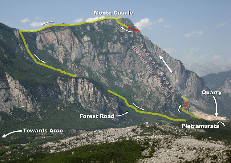
A view of Monte Casale, with the route of the Ferrata Che Guevara (plus descent route) overlain. Note that the town of Pietramurata is mostly hidden in this view behind a rise in the foreground (which is where the start and end points of this route are located). Also note that the bulk of the ferrata route is hidden behind a large buttress, as seen from this angle. The very steep forest descent route can be seen on the far left (i.e. the steep part of the yellow line). Red = ferrata/climbing, yellow = trail (or scrambling).
This image is from the presentation "Via Ferrata - Protected Climbing Paths in the Dolomites - Via Ferrata Che Guevara".
 Go to presentation where this image occurs.
Go to location in presentation where this image occurs.
Go to presentation where this image occurs.
Go to location in presentation where this image occurs.
Copyright 2001-2016 alavigne.net.