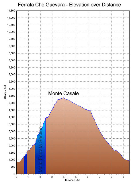
A GPS-derived elevation profile of the Che Guevara ferrata route, graphed over distance. The spots with significant continuous ferrata climbing are denoted with the blue shading.
This image is from the presentation "Via Ferrata - Protected Climbing Paths in the Dolomites - Via Ferrata Che Guevara".
 Go to presentation where this image occurs.
Go to location in presentation where this image occurs.
Go to presentation where this image occurs.
Go to location in presentation where this image occurs.
Copyright 2001-2016 alavigne.net.