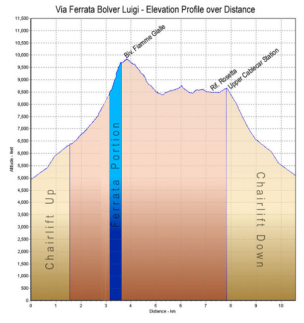
This is a GPS-derived elevation profile, graphed over distance. Blue section indicates the actual ferrata portion. The gold sections indicate the chairlift ascent and descent portions.
This image is from the presentation "Via Ferrata - Protected Climbing Paths in the Dolomites - Via Ferrata Bolver Luigi".
 Go to presentation where this image occurs.
Go to location in presentation where this image occurs.
Go to presentation where this image occurs.
Go to location in presentation where this image occurs.
Copyright 2001-2016 alavigne.net.