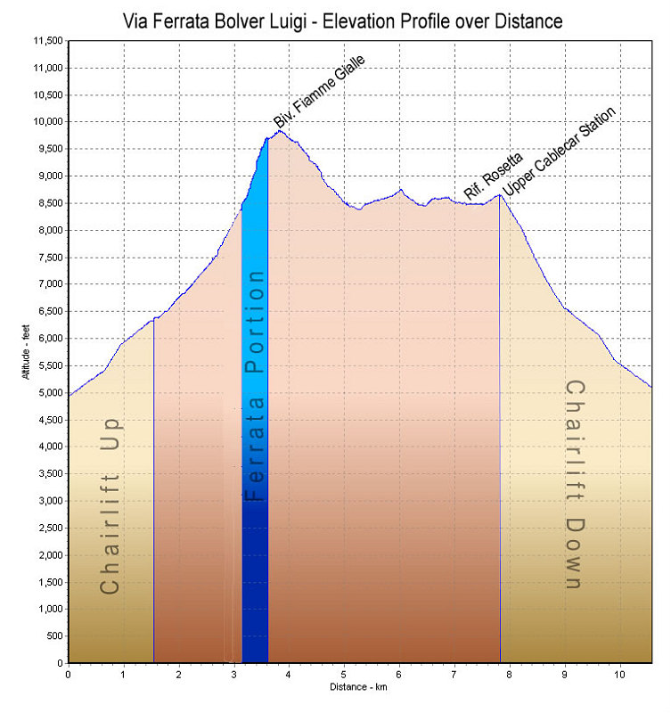
This is a GPS-derived elevation plot of our 2-day climb of the Ferrata Bolver Luigi, graphed over distance.
This image is from the presentation "The Dolomites and Via Ferrata 2007 - The Pale di San Martino and the Ferrata Bolver Luigi".
 Go to presentation where this image occurs.
Go to location in presentation where this image occurs.
Go to presentation where this image occurs.
Go to location in presentation where this image occurs.
Copyright 2001-2016 alavigne.net.