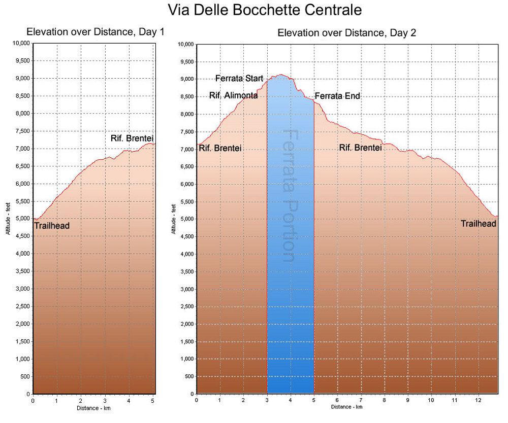
This is a GPS-derived elevation profile of our climb in the Brenta, graphed over distance. We climbed over a two-day period. The actual ferrata portion of the climb is marked in blue.
This image is from the presentation "Italy 2005 - The Dolomites".
 Go to presentation where this image occurs.
Go to location in presentation where this image occurs.
Go to presentation where this image occurs.
Go to location in presentation where this image occurs.
Copyright 2001-2016 alavigne.net.