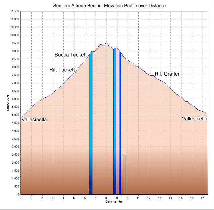
This is a GPS-derived elevation profile of a loop outing involving the Sentiero Alfredo Benini (aka BREN1 in the fletcher / smith guidebooks). The start and end point of the loop is the upper Vallesinella parking lot.
This image is from the presentation "Via Ferrata - Protected Climbing Paths in the Dolomites - Sentiero Alfredo Benini".
 Go to presentation where this image occurs.
Go to location in presentation where this image occurs.
Go to presentation where this image occurs.
Go to location in presentation where this image occurs.
Copyright 2001-2016 alavigne.net.