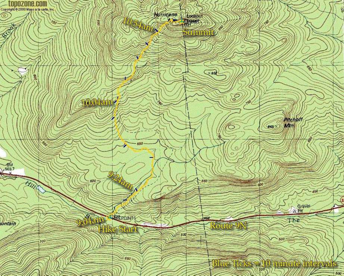
This map shows the GPS tracklog of our hike. The blue tick marks indicate 10-minute intervals. Hike start was at 9:04 am. Note that the trail indicated on the topo is not the route that the trail currently takes (some of these maps are quite out of date).
This image is from the presentation "Hurricane Mountain".
 Go to presentation where this image occurs.
Go to location in presentation where this image occurs.
Go to presentation where this image occurs.
Go to location in presentation where this image occurs.
Copyright 2001-2016 alavigne.net.