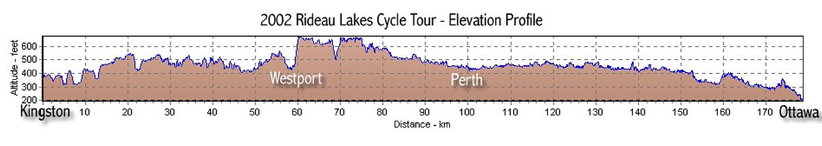
This graph shows the elevation profile derived from the GPS tracklog of our ride. You can definitely see the Westport hill.
This image is from the presentation "2002 Rideau Lakes Cycle Tour".
 Go to presentation where this image occurs.
Go to location in presentation where this image occurs.
Go to presentation where this image occurs.
Go to location in presentation where this image occurs.
Copyright 2001-2016 alavigne.net.