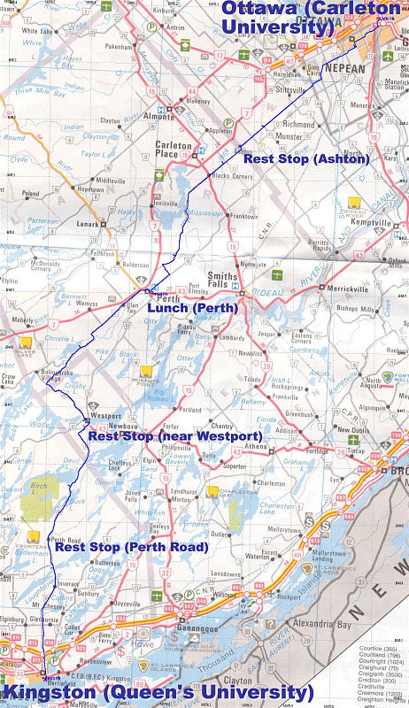
This is a highway map of the route, with our GPS-tracklog annotated over top of it.
This image is from the presentation "Rideau Lakes Cycle Tour 2003".
 Go to presentation where this image occurs.
Go to location in presentation where this image occurs.
Go to presentation where this image occurs.
Go to location in presentation where this image occurs.
Copyright 2001-2016 alavigne.net.