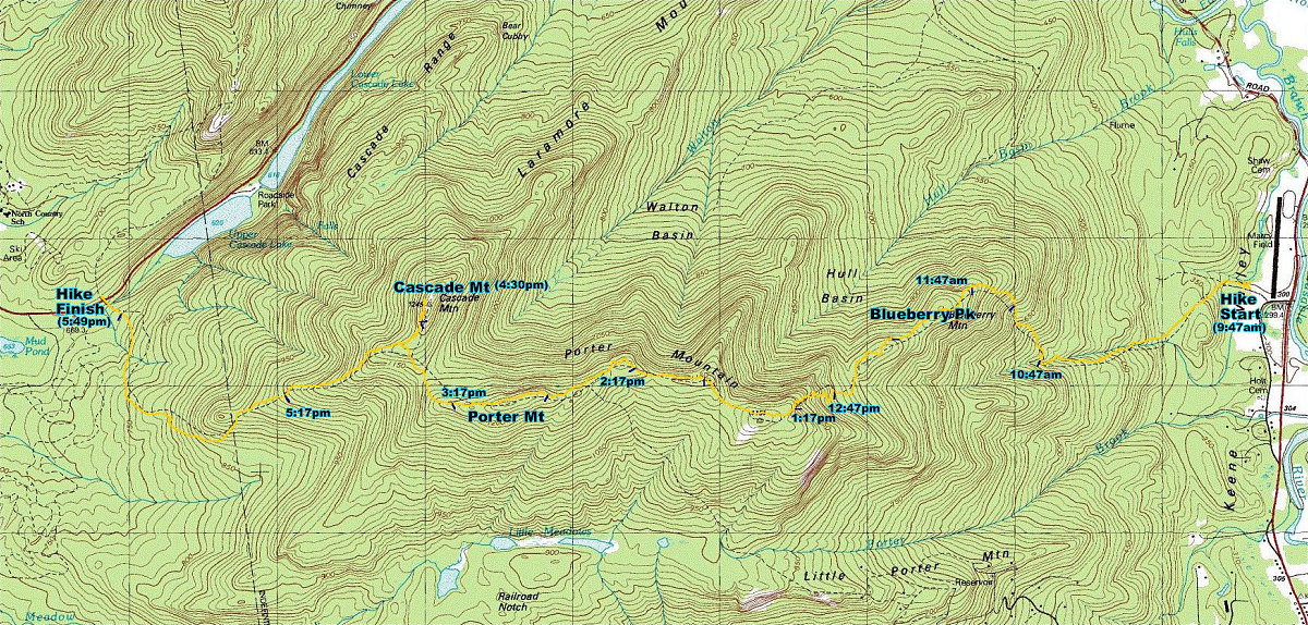
This is an annotated topographic map of the Route taken. Starting from Marcy Field in Keene Valley at 9:47am EST, the hike wound over Blueberry peak and porter ridge to Porter Mountain (4059'), and then on to Cascade Mountain (4098'). The yellow line is the GPS tracklog, and the blue ticks along that line represent 30 minute intervals.
This image is from the presentation "Porter Cascade 2002".
 Go to presentation where this image occurs.
Go to location in presentation where this image occurs.
Go to presentation where this image occurs.
Go to location in presentation where this image occurs.
Copyright 2001-2016 alavigne.net.