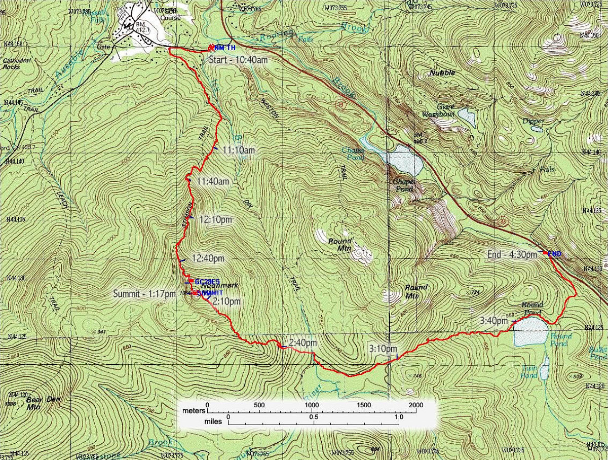
This is an annotated topographic map of the hike, showing the exact path we took from start to finish (path information obtained from my GPS unit).
Total distance: 9.4 km.
Average Speed: 1.6 km/hr (including all stops).
Start time: 10:40am
Finish time: 4:30pm
Start altitude: 1300ft
Summit altitude: 3556ft
End altitude: 1600ft
This image is from the presentation "Noonmark Traverse".
 Go to presentation where this image occurs.
Go to location in presentation where this image occurs.
Go to presentation where this image occurs.
Go to location in presentation where this image occurs.
Copyright 2001-2016 alavigne.net.