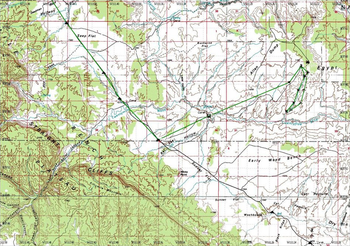
This is a Topgraphic Map of the Egypt 3 hike, and a rough GPS route with waypoints drawn in. Also included is a route and some waypoints for getting to the start of the hike from the town of Escalante. The GPS route and waypoint data is available by clicking on the GPS data link in the left hand column.
This image is from the presentation "Desert Southwest 2001".
 Go to presentation where this image occurs.
Go to location in presentation where this image occurs.
Go to presentation where this image occurs.
Go to location in presentation where this image occurs.
Copyright 2001-2016 alavigne.net.