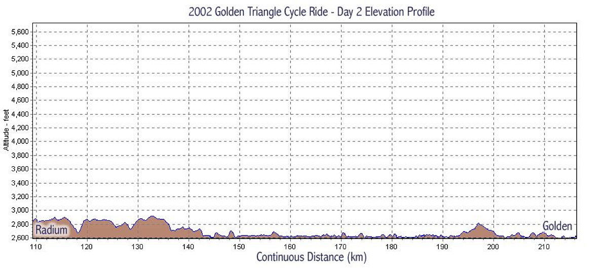
This graphic is a GPS-data derived representation of the elevation profile of the second day of the ride. As you can see, it is mostly flat, although there are still a lot of small ups and downs.
This image is from the presentation "The EVCC Golden Triangle Cycle Ride - Map Page".
 Go to presentation where this image occurs.
Go to location in presentation where this image occurs.
Go to presentation where this image occurs.
Go to location in presentation where this image occurs.
Copyright 2001-2016 alavigne.net.