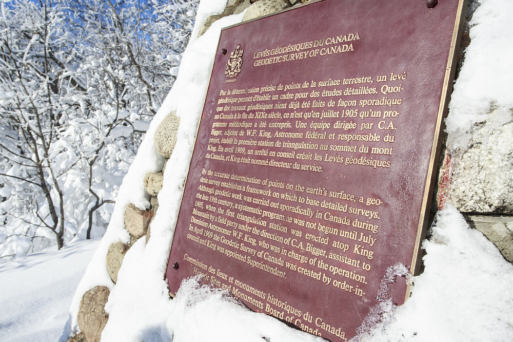
A pyramidal monument atop King Mountain in Gatineau Park. The monument commemorates the first geodetic survey triangulation station, which was set-up on this point in 1905. The subsequent Geodetic Survey of Canada went on to create a set of nationwide precision triangulation points that were (and are) used in mapping, navigation, geology, and for other georeferencing needs.
This image is from the presentation "King Mountain Snowshoe".
 Go to presentation where this image occurs.
Go to location in presentation where this image occurs.
Go to presentation where this image occurs.
Go to location in presentation where this image occurs.
Copyright 2001-2016 alavigne.net.