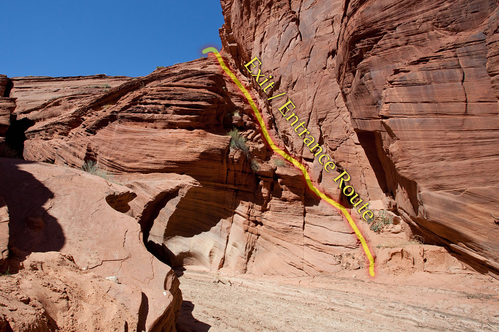
A view of the 'Middle Trail' Exit Point. The exit/entrance route goes up the diagonally-sloped ledges above and to the right of Kyle. Note that this view only shows about 30-40 feet of the entire Middle Trail route; above this, I believe the slope lessens considerably.
This image is from the presentation "Southwestern Burnup Tour - Buckskin Gulch Backpack Day 2".
 Go to presentation where this image occurs.
Go to location in presentation where this image occurs.
Go to presentation where this image occurs.
Go to location in presentation where this image occurs.
Copyright 2001-2016 alavigne.net.