This is a GPS-derived elevation plot of our day's hiking, graphed over distance.
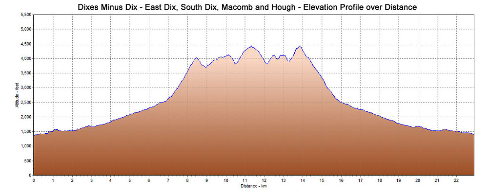
This image is from the presentation "Dixes minus One: East Dix (Grace), South Dix (Carson), Macomb and Hough via Boquet River Approach".
 Go to presentation where this image occurs.
Go to location in presentation where this image occurs.
Go to presentation where this image occurs.
Go to location in presentation where this image occurs.
Copyright 2001-2016 alavigne.net.