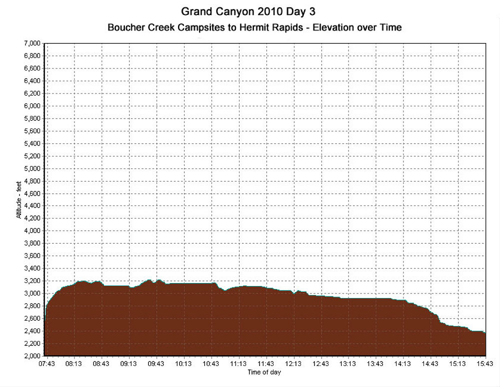
This is a GPS-derived elevation plot of the third day of our backpack, graphed over time.
This image is from the presentation "Grand Canyon - Boucher, Tonto, Bright Angel - Backpack Day 3: Tonto Trail, Boucher Creek to Hermit Rapids".
 Go to presentation where this image occurs.
Go to location in presentation where this image occurs.
Go to presentation where this image occurs.
Go to location in presentation where this image occurs.
Copyright 2001-2016 alavigne.net.